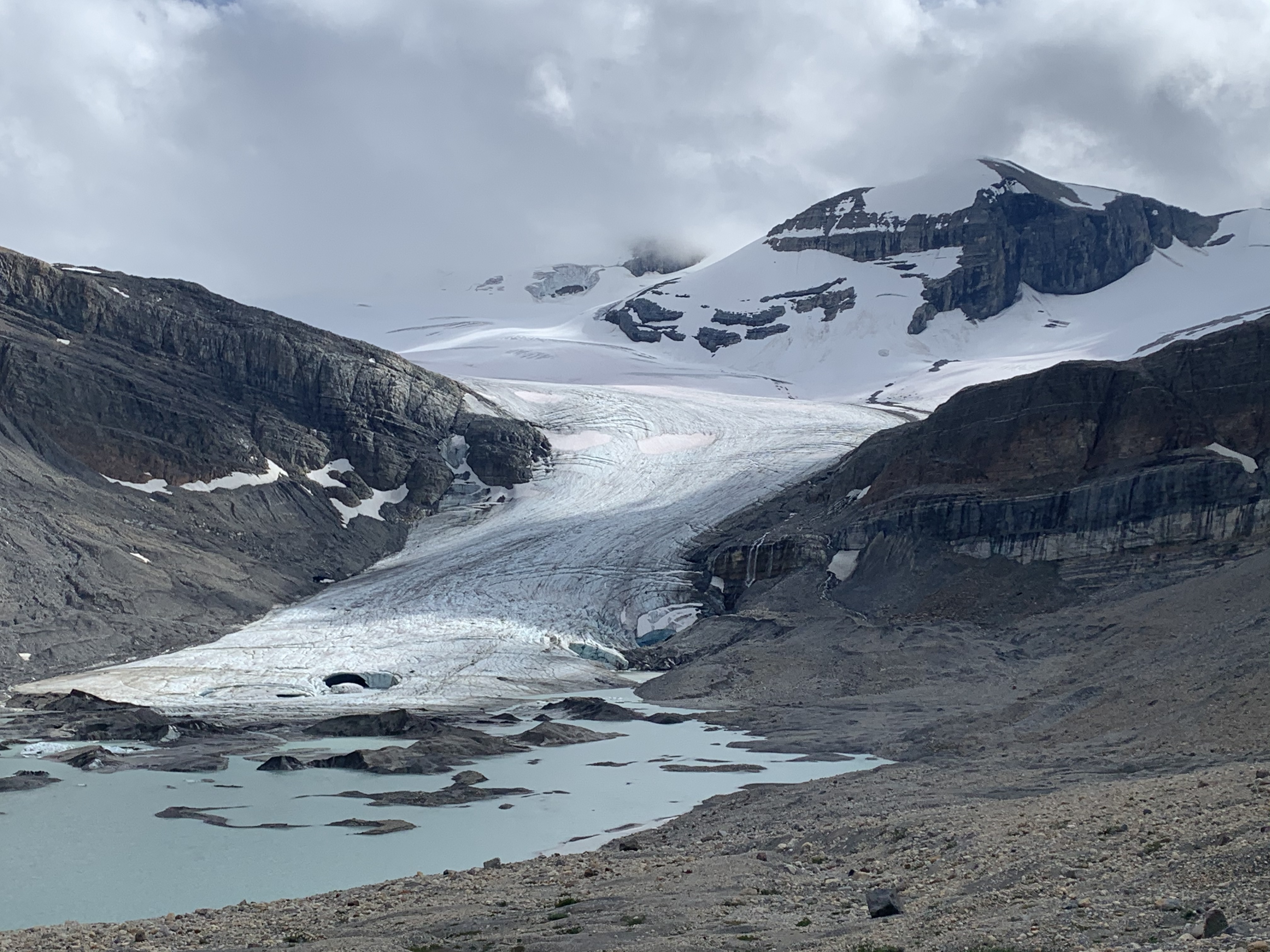
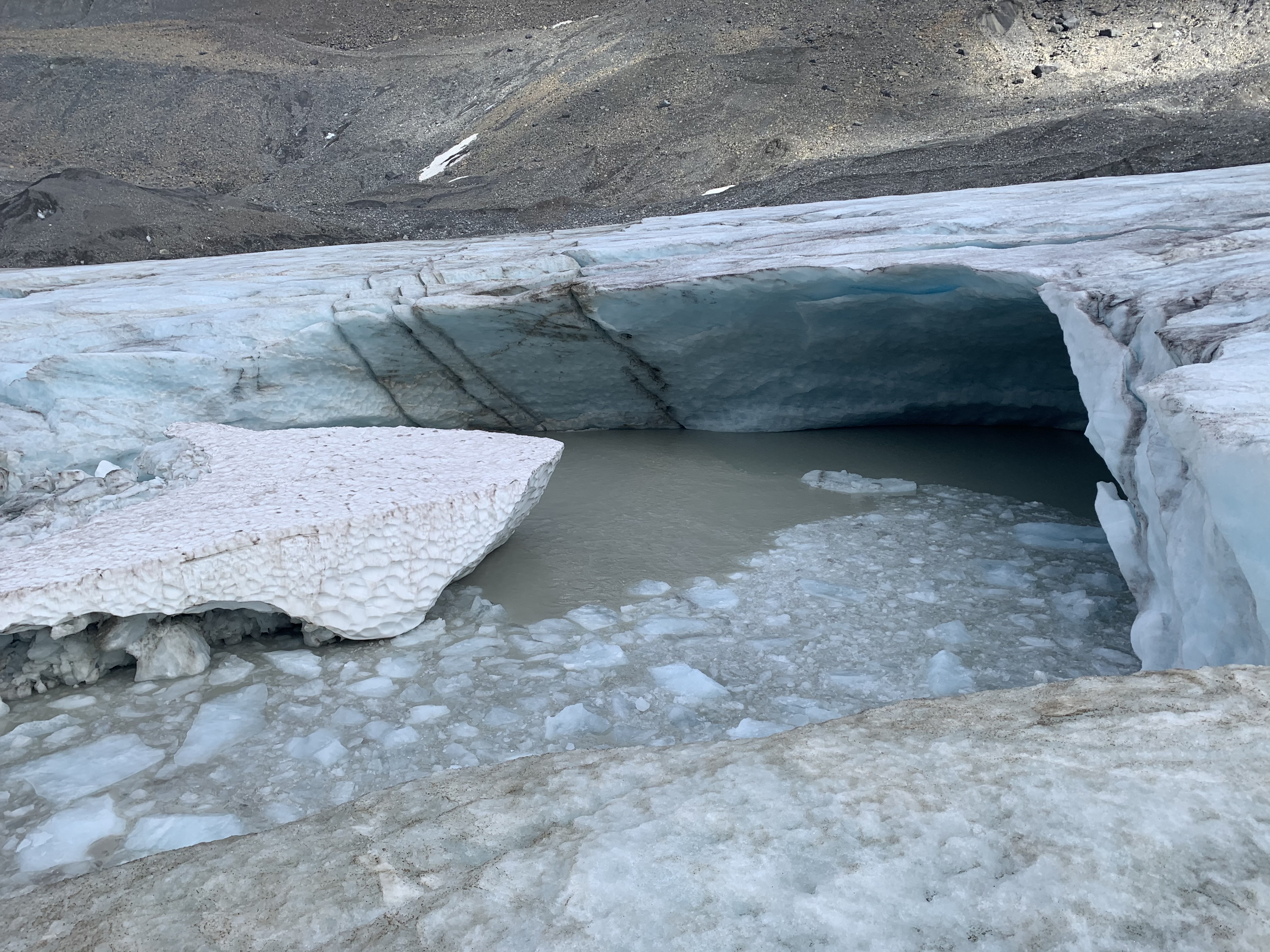
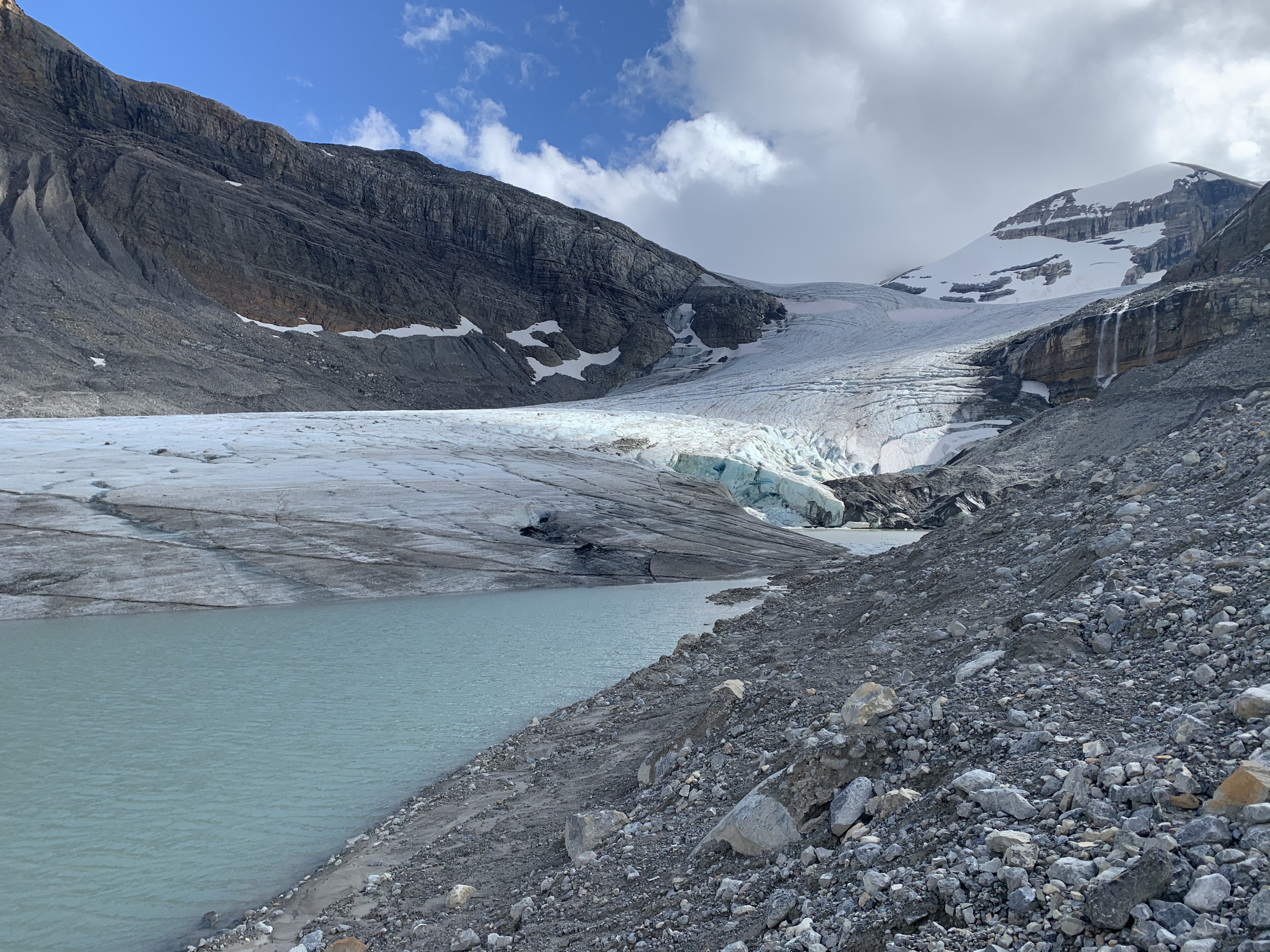
Just returned from a Peyto to Bow hut trip. On August 6, we parked at the alternate parking for Peyto hut (the winter approach), due to construction at Bow summit. While the trail to the lake shore is great, our Parks Canada pamphlet suggested an unmaintained trail goes along the shore of Peyto lake. Unfortunately, we found no such trail and we committed to a medium-heavy bushwhack that’s hard to recommend. If we missed the trail, please let me know. Both Peyto (crossed at lake shore) and Cauldron creek were boots-off crossings. Our final surprise was the view of the Peyto glacier from the glacial research station, after crossing Cauldron creek. The glacier has a large new collapse in the centre (around 100x60m area and ~30-40m deep) and the traditional access from lookers right to gain the glacier was a 10m strip of ice that was not under water. We came very close to taking our boots off a third time. From there, all-ice travel to the hut. When exiting the glacier at the hut, the end of the normal trail (just S of the outflow of the alpine tarn) is now severely undercut and a large moat exists between the glacier and the moraine, still somewhat snow covered. We exited slightly earlier to avoid this.
Overnight and during August 7 snow line came down to 2700m with rain, sleet and snow at the hut till 1600, which kept us hut bound most of the day. August 8 was cool (3C @ 0700) with light rain when we traversed to the Bow hut. We had a limited refreeze on the icefield proper with the fresh snow creating wind drifts (mid boot) in the sun cups, coverage 0-150cm. Currently, the descent to the bow hut is still all snow, albeit thin coverage.
Given our approach challenges, if I had another Peyto hut booking, I would approach via the Bow hut trail. Certainly disheartening to see these drastic changes from this year to last year of the Peyto glacier.