From August 19th to 23rd practicum guide, Tim Johnson, and I guided an ascent of the 1925 Japanese route on Mt Alberta with one guest. Overall this was a physically demanding trip that changed from summer to winter over the night of August 21st.
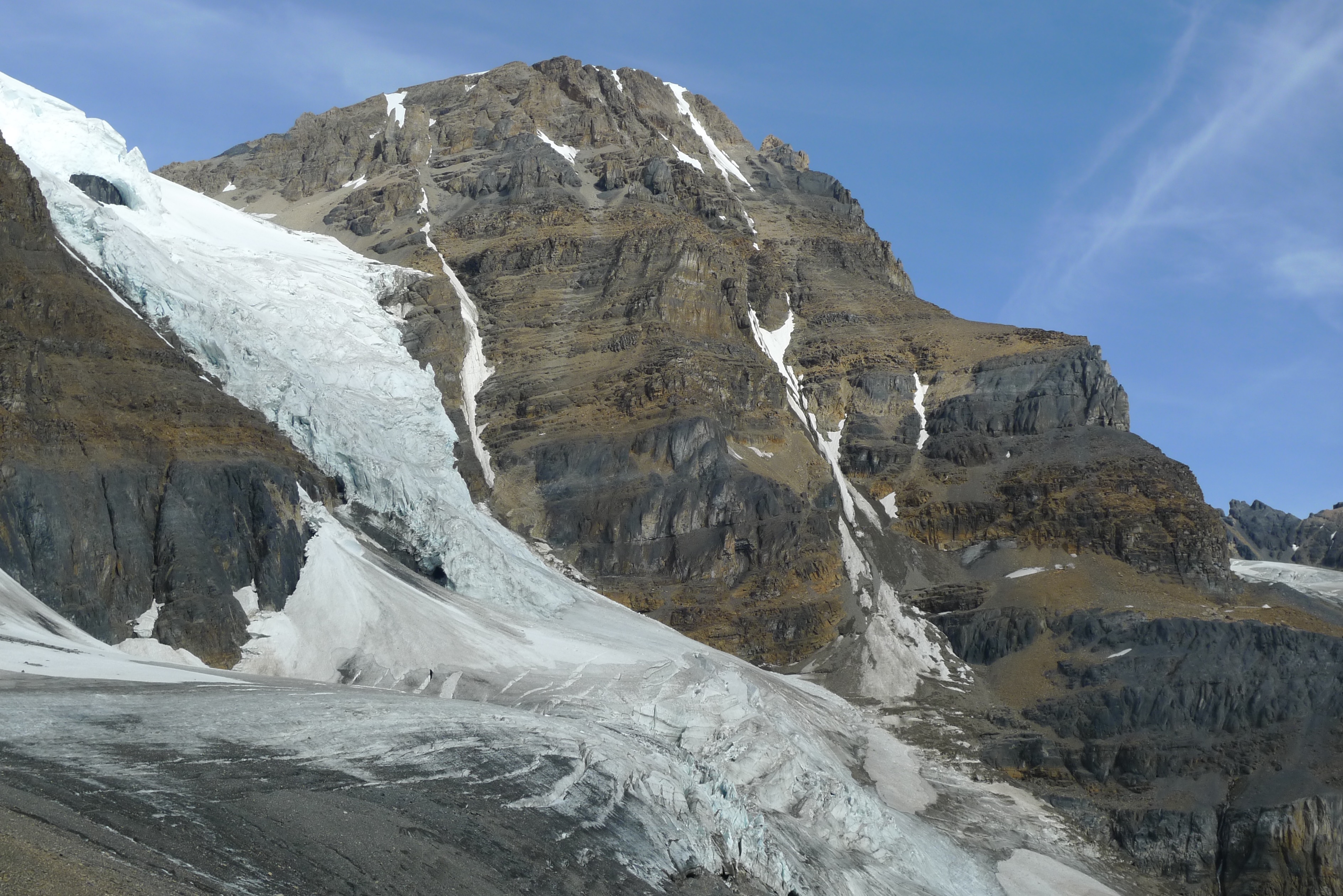
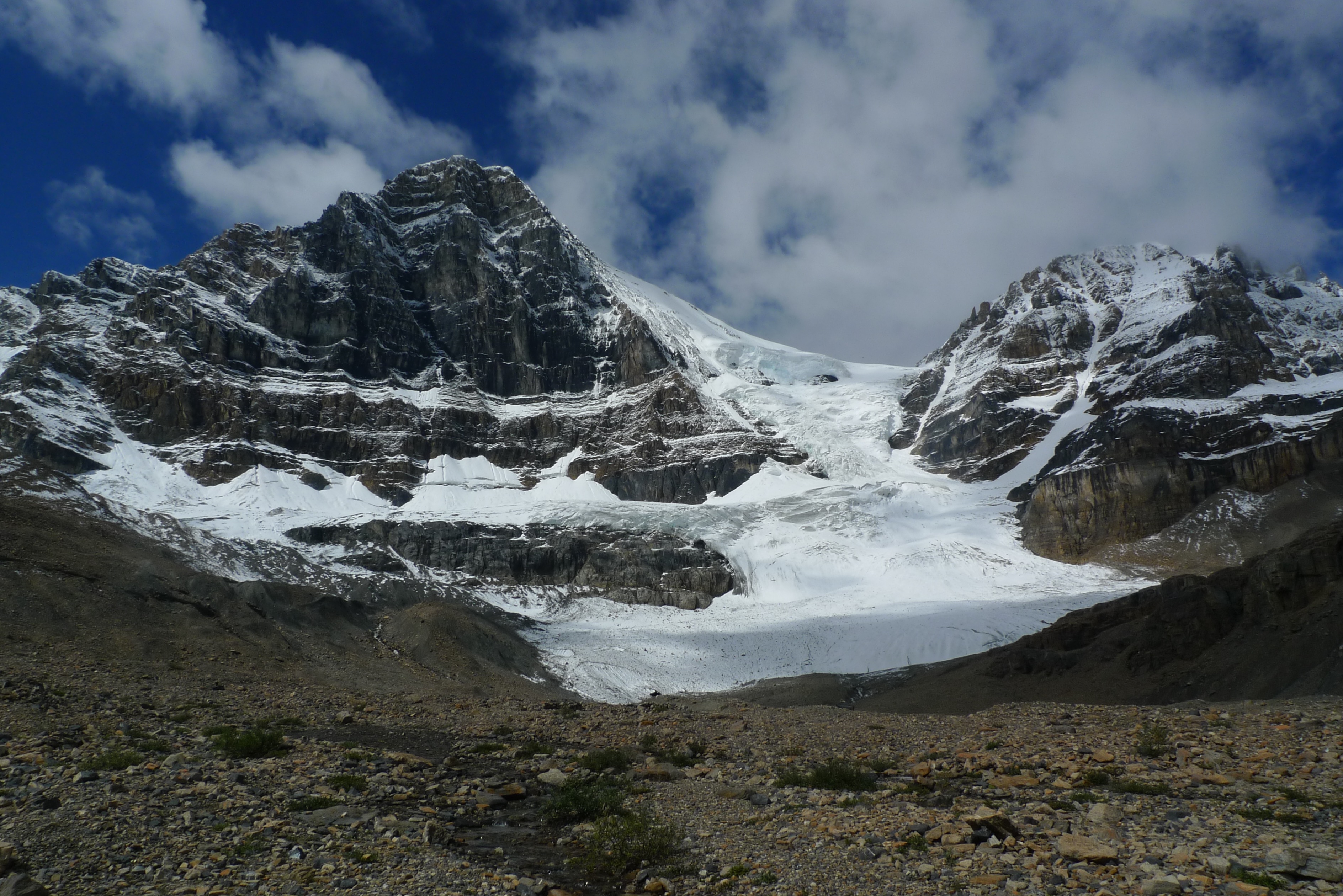
August 19th we forded the Sunwapta River at dawn with spare footwear and a towel, all left hanging in a tree on the far side. The wading was never deeper than knee. From the Woolley/Diadem tent corrals a new-to-me shortcut since my 5 crossings of Woolley shoulder (1982-1992) is to follow cairns due south up a lateral moraine then corkscrew west on said moraine into the valley leading to Woolley Shoulder. We stayed on the high ground of the moraine, but it is better to get down into the gut of the valley and approach Woolley Shoulder from that low point (one tent corral there). Woolley Shoulder looks improbable with overhangs at its top and memory is a fickle bedmate ... keep to the centre of the slope and the right trending exit will be revealed. DO NOT GO into the steep chute on the climber's right that can be spitting stones, it is a trap. From the shoulder we contoured the glacier on firn snow until we ran into crevasses and put on the rope and crampons on. We crossed several hundred metres of bare ice to get to the hut. Our approach was about 9 hours. Maartin and Sebastian shared the hut with us that night and left very early for the NE ridge of Mt Alberta.
August 20th we meandered to a high bivy 50 metres below the start of the roped climbing that proved to be in the line of rockfall from Maartin and Sebastian's last rappel on their way down from climbing the NE ridge that day. We were able to communicate with them and they took good care not to dislodge rock and we were grateful for that and rewarded them with milky sweet tea and an insolite pad to sit out the night on (they arrived by headlamp). It seems to me that the first "Elephant's Ass' looks like one, then all others are a stretch of the imagination. An "open arch" marks the normal start (I'd call it a window through the rock) but it is difficult, if not impossible, to see until you are level with it.
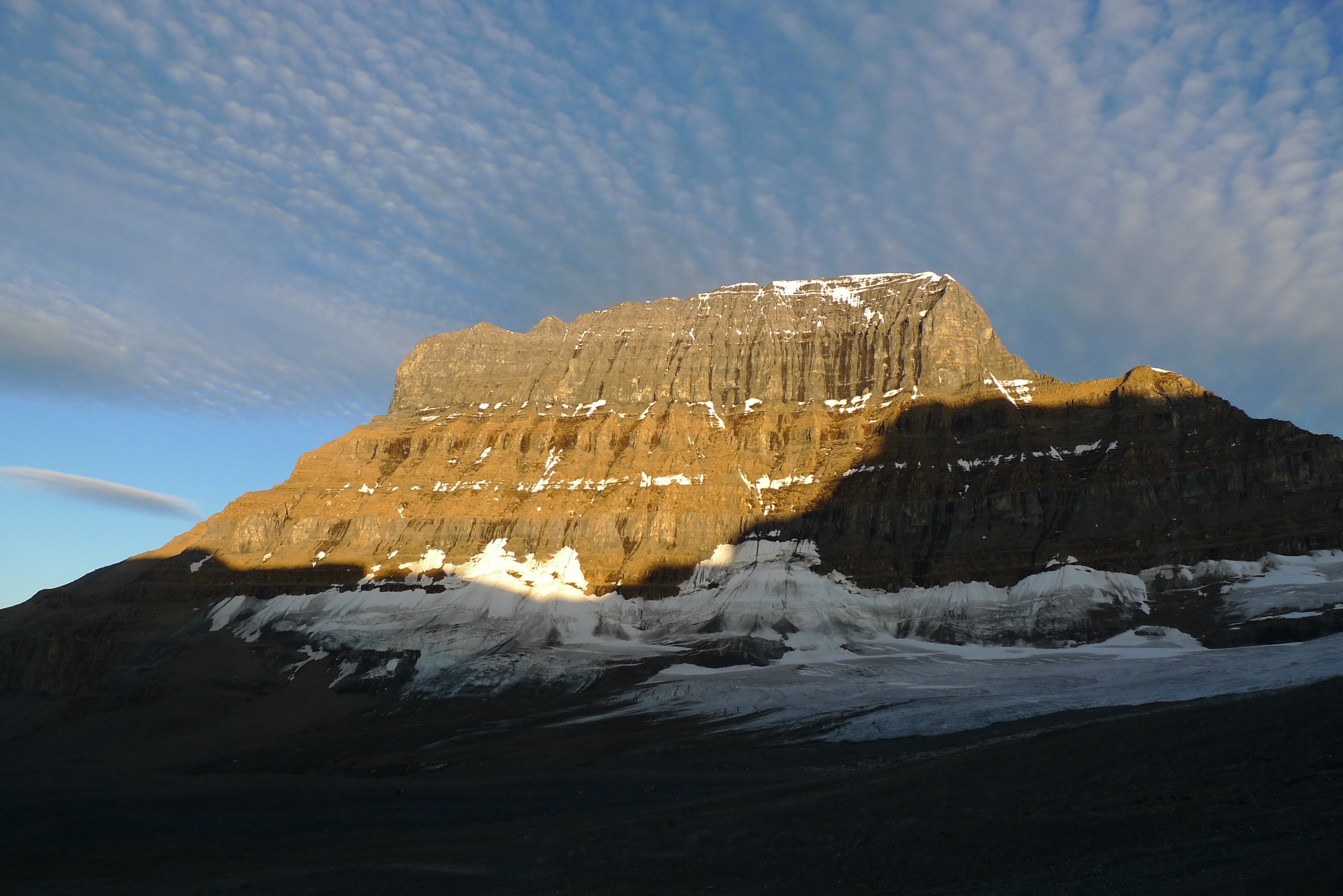
August 21st we started too far to the climber's right below a rappel anchor and did three pitches of challenging climbing that would not have been necessary had we started 50 metres climber's left. Note that our first pitch crossed the drainage of the broad gulley that is the feature that forms the route. Don't go there. Start further south, preferably on the easiest variation marked here: http://members.shaw.ca/efee/MtAlberta.pdf A helpful trip report here: http://benthereclimbedthat.ca/content/mount-alberta
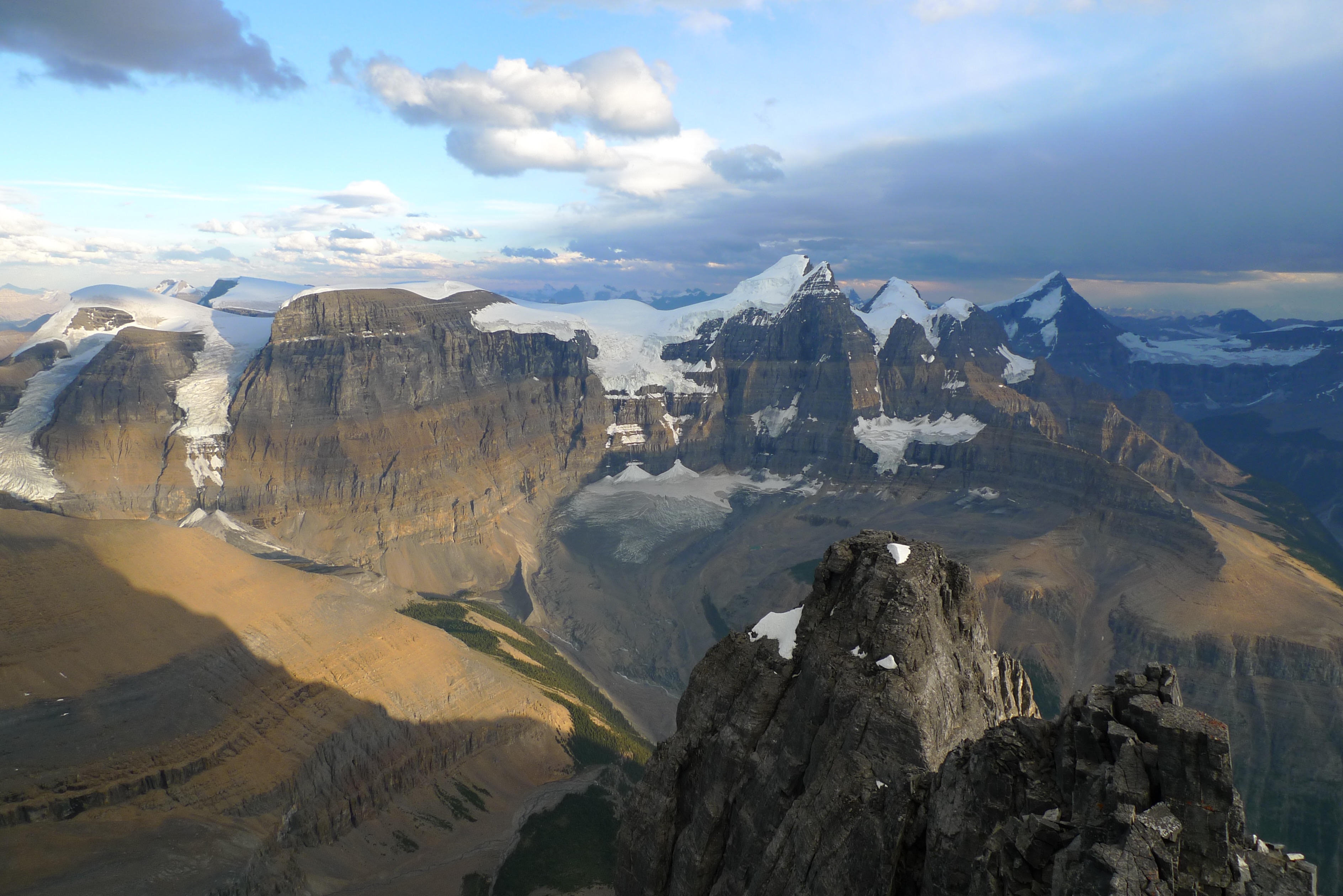
Once on route we followed it until snow and ice in the gulley looked faster and we finished the last two pitches with crampons on, ice axe in hand, snow and ice underfoot and anchorage on ice screws. It is possible to exit the cul-de-sac topping the gully via a balancey move right onto rock. The summit ridge only had a couple of cornice moves and we topped out at about 7 pm. God bless Tim for hustling us back across the ridge enabling us to make half of the rappels before switching our headlamps on. We arrived at our high bivy around midnight and it started to snow. I left my bivy sac and squeezed into the two man tent with the lads.
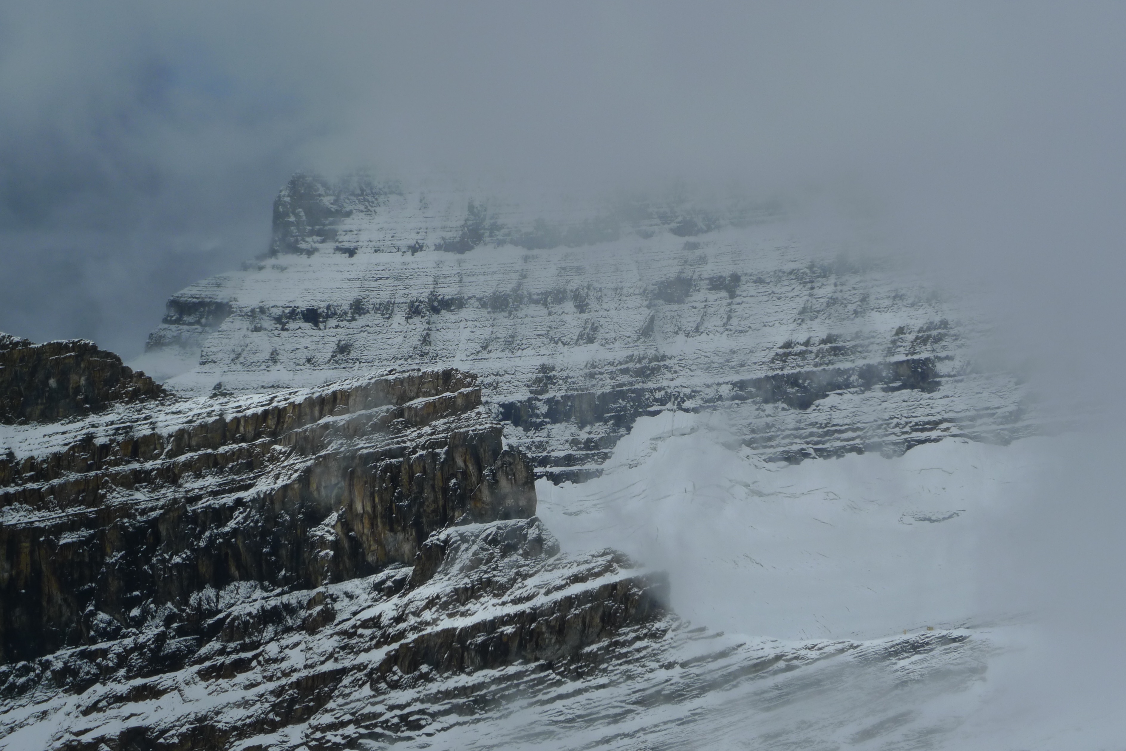
August 22nd:"It looks Himalayan out there" Tim said in the morning. 10 cms of snow lay on all and visibility was down to 10s of metres. We made a bum sitting, trail breaking descent through constant snow, a half dozen rappels, several saves of our location via my clients dedication to marking tracks on his gps/personnel locator device, much dead reckoning on my part, we got to the hut at 4 pm after 7 hours on the go. 20 cms of snow had accumulated with no wind to speak of.
August 23rd. The wind came in the night and pillowed the snow into swells of cream cheese that thankfully did not want to avalanche. Dealing with eggshell crusts over crevasses got tedious, as did the whiteout. We got off of the glacier via gps, map and compass and the weather started to break up at Woolley Shoulder, bless our lucky stars! The cream cheese snow actually made descending Woolley Shoulder a little easier, we even bum slid some of it.
Happy trails,
Barry Blanchard
Mountain Guide
Yamnuska Mountain Adventures