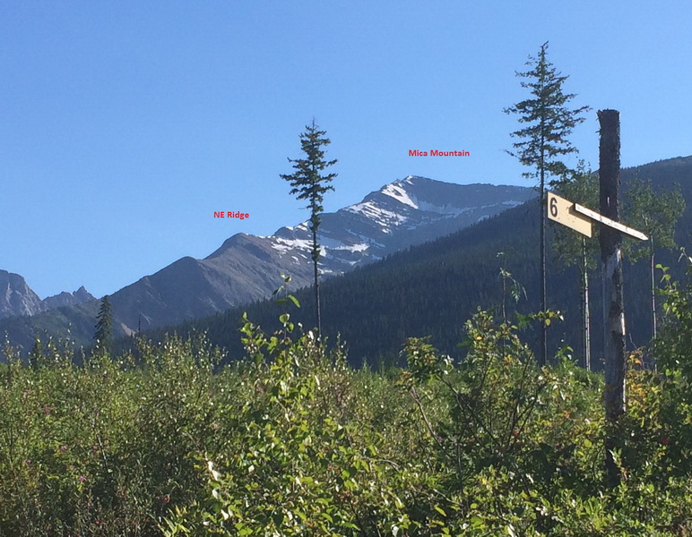
Mica Mountain NE Ridge Centre direct
Mica Mountain NE ridge Primier Range Caribou Mountains

Aug 7, 2017
Yesterday I went to look at access to the true NE ridge on Mica Mountain and ended up reaching the summit. I haven't heard of anyone else climbing this ridge but the goats of the area certainly have.
I parked just before the km10 sign on the Sande Creek logging road, where there is a recent cutblock.
From there it is ~2.5 hours of bush. The lower mid section was "not to bad" by BC standards but at around 5700ft the bush gets thick. It was best to stay right of the ridge about.
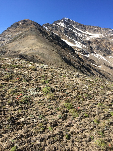
Once in the open the ridge is quite pleasant to follow with spectacular views of the drainage's on either side. The ridge that leads to the Mice mine parallels this ridge. Though travel is mostly simple, a few sections of 3rd class are passed along the way, and there is a short steep section of 4th class mid way. A short section of exposed 4th class quartzite is encountered near the summit. I passed some of this on the north side between the ridge and an old cornice to get into the shade, and to avoid a steep short exposed rib. The descent is reverse the route.
It took 1.5 hours to descend the bush from treeline on the ridge. There may be other options of gaining or descending the ridge into the drainage to the south via the pick up road for Caribou cat skiing which can be gained just to the south. (Not sure of the status of this road for non ATV vehicles)
Round trip was about 9.5 casual hours. Though the bush is not enticing, once on the ridge it is a direct straight line to the summit.
I found this ridge to be very pleasant (once out of the trees) and avoids the chossy loose headwall that is encountered on ridge above the Mica Mine trail route. A short rope of about 20 meters, a few slings and helmets could be useful to manage the exposure in the few sections described.
Peter Amann
Mountain Guide